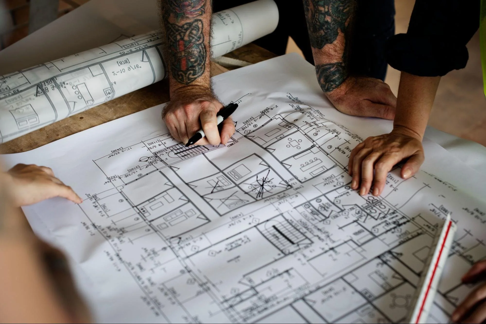
Clear, accurate plans guide every commercial and industrial build from start to finish. Property owners face tight timelines, rising costs, and strict compliance demands that leave little room for error. CAD drafting provides a digital method for creating precise technical drawings that support confident decision-making. These drawings replace unclear sketches with measurable, editable, and shareable designs across teams. Strong drafting practices help reduce risk while improving coordination and project outcomes.
CAD Drafting in Modern Design
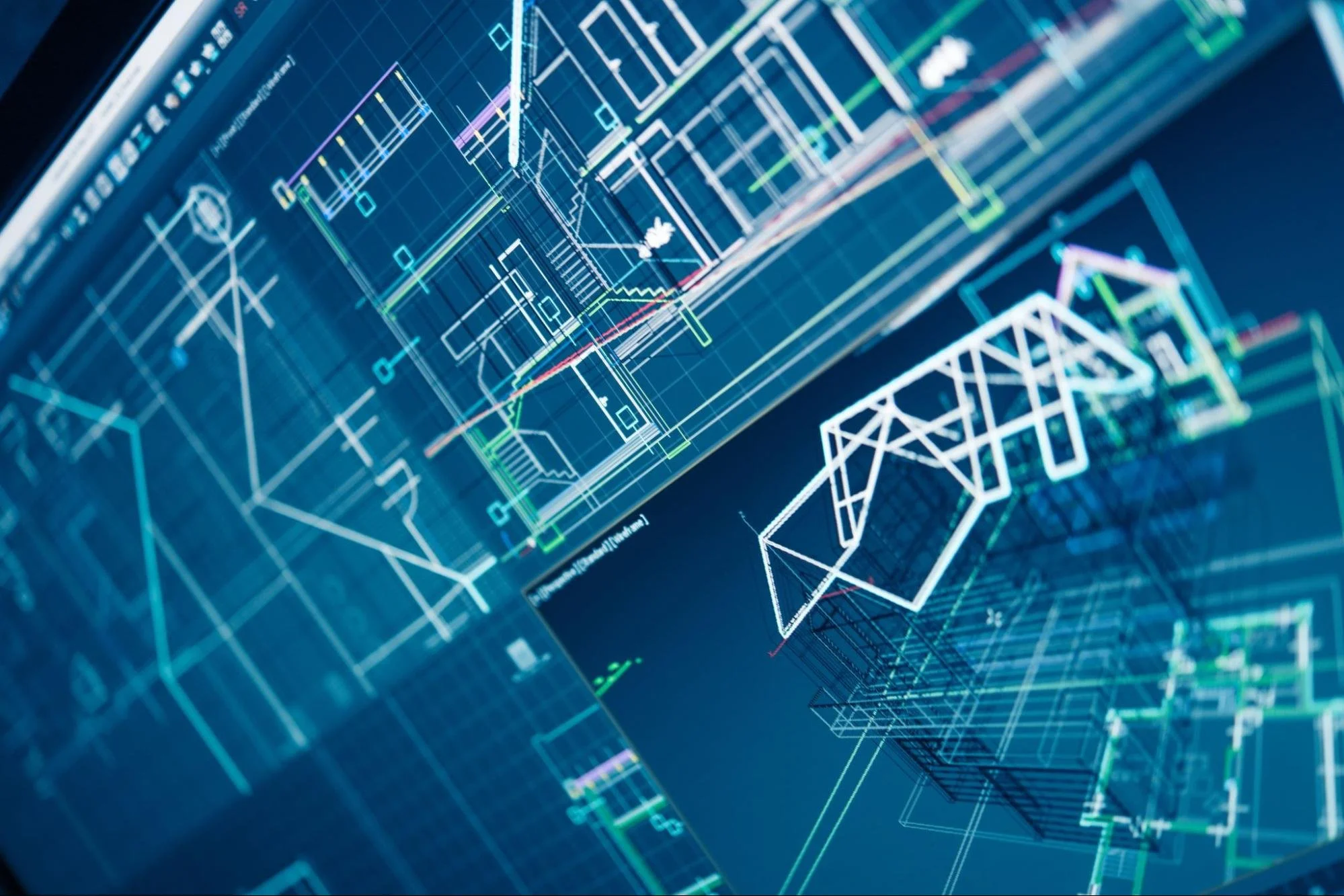
CAD drafting is the process of creating technical drawings using computer-aided design (CAD) software for design and construction. This method replaces manual drafting with digital precision, allowing teams to edit and scale designs quickly. This approach improves coordination between architects, engineers, and contractors throughout the project lifecycle. Property owners gain clearer visibility into layouts, systems, and specifications before construction begins.
What CAD Drafting Means in Practice
CAD drafting means producing detailed digital drawings that define dimensions, materials, and layouts for a project. This process uses software tools to maintain consistent scale and alignment across all design elements. Unlike hand-drawn plans, digital drafts allow quick revisions without recreating entire drawings. This flexibility reduces delays and supports faster decision-making during design stages. Additionally, CAD files store data that teams can reuse for future modifications or expansions. Property owners benefit from accurate documentation that supports efficient construction and long-term planning.
CAD Drafting in Property Development
CAD drafting supports planning, approvals, and execution across commercial and industrial developments. This system allows teams to present detailed drawings for permits and regulatory reviews. Contractors rely on these files to interpret measurements and construction requirements with precision. Engineers use shared models to coordinate structural and system designs. This coordination reduces conflicts that often arise during construction phases. Property owners gain better control over timelines and project costs through clear digital documentation.
CAD Drafting Tools and Features
CAD drafting systems combine advanced software with structured design elements to produce accurate drawings. This setup allows professionals to organize complex information into clear, readable formats. This structure improves collaboration across multiple teams working on the same project. Property owners benefit from consistent documentation that supports efficient communication and execution.
CAD Software for Drafting Projects
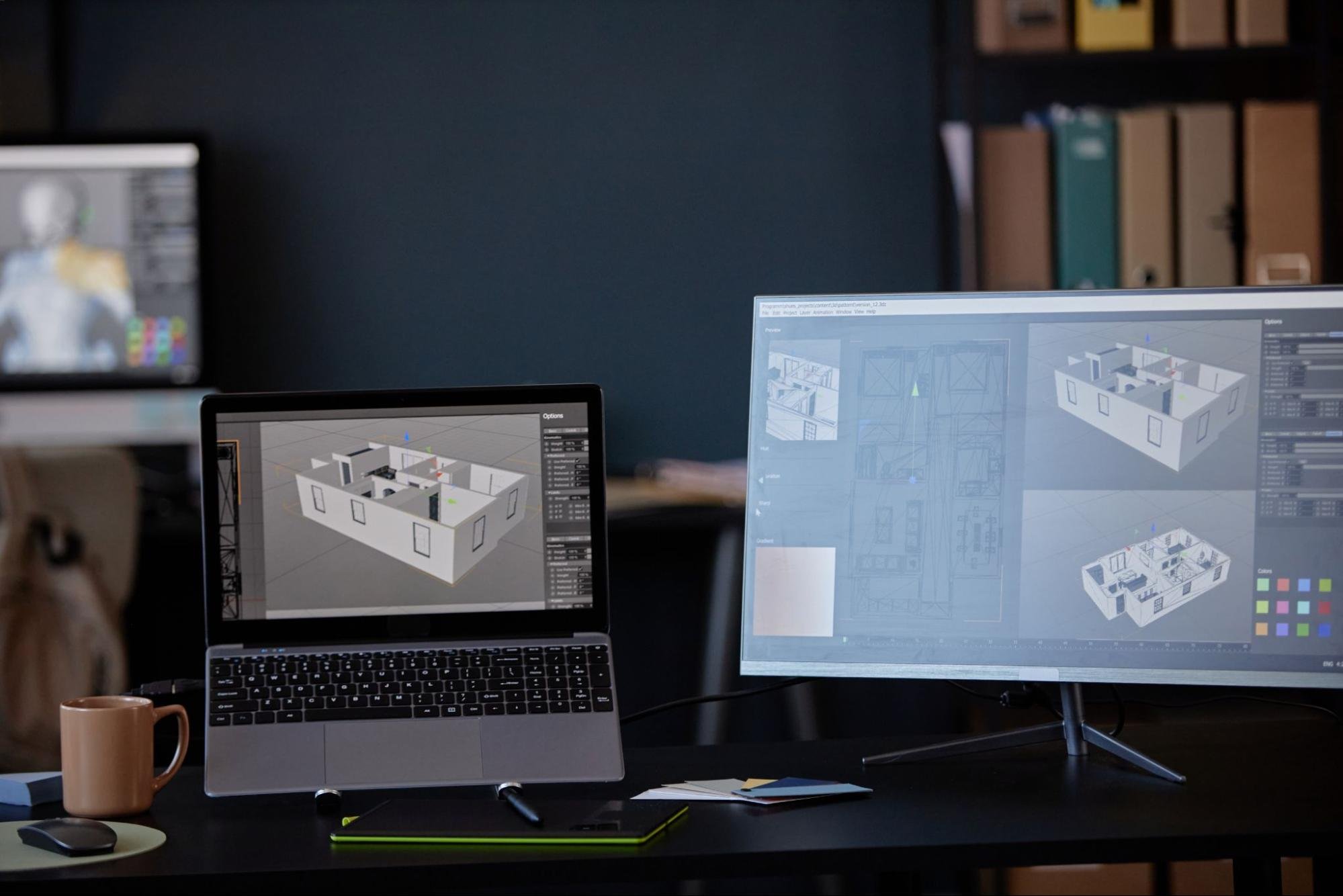
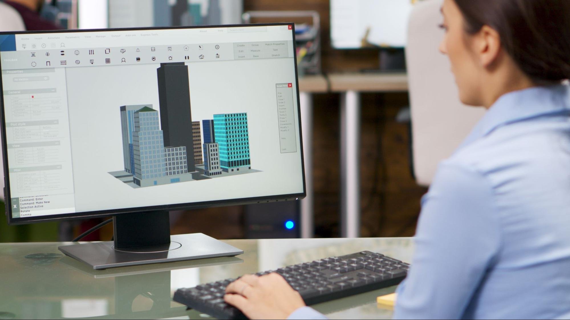
Digital drafting relies on software like AutoCAD for detailed 2D drawings and layouts. Many professionals also use SolidWorks for advanced 3D modeling and engineering design. These tools allow users to create scalable drawings with precise measurements and annotations. This capability supports both conceptual planning and technical documentation within a single platform. CAD software enables file sharing across teams, which improves collaboration. Property owners receive updated designs quickly, which helps maintain project momentum.
Key Elements in CAD Drawings
CAD drawings include layers that separate structural, electrical, and mechanical components within a design. This organization allows users to edit specific sections without affecting the entire drawing. Dimensions provide exact measurements that guide construction teams during execution. Annotations clarify materials, finishes, and installation instructions within each drawing. This structure improves readability and reduces confusion among project stakeholders. Property owners gain confidence from clear, standardized documentation that supports accurate implementation.

CAD Standards and Compliance
CAD drafting follows structured standards that influence design quality and approval processes. Many property owners focus on visuals but overlook technical requirements within drawings. Aligning with established standards helps prevent delays and costly revisions.
Industry Standards in CAD Drawings
CAD drawings follow conventions for layers, line weights, and annotation formats. These standards improve clarity and consistency across project teams. Regulatory bodies often expect drawings to meet these requirements during submission. Standardized formats reduce confusion during construction phases. This consistency supports smoother collaboration between professionals. Property owners benefit from faster approvals and clearer documentation.
Meeting Codes and Project Requirements
CAD drafting must comply with building, zoning, and safety codes. These requirements influence layout design and system placement decisions. Failure to meet them can delay approvals or require redesign work. Industrial projects often include stricter compliance standards. This complexity underscores the need for accurate, detailed drafting. Property owners gain confidence by working with teams familiar with these requirements.
Benefits of CAD Drafting Services
CAD drafting improves accuracy, efficiency, and communication across property development projects. This approach reduces uncertainty by providing detailed and consistent design information. This clarity helps teams avoid costly mistakes and delays during construction. Property owners benefit from stronger control over project outcomes and resource allocation.
Accuracy and Error Reduction
Automated measurements and standardized design tools help reduce errors in technical drawings. Designers can verify dimensions before construction begins, which minimizes rework. Digital files maintain uniformity across all documents and revisions. This consistency prevents discrepancies that often lead to costly corrections. Teams rely on accurate drawings to execute plans without confusion. Property owners benefit from fewer disruptions and more predictable outcomes.
Faster Design and Project Delivery
Efficient editing and duplication tools help speed up the design process. Designers can adjust layouts without having to start from scratch each time. Faster revisions allow teams to respond quickly to changes or feedback. Streamlined workflows reduce delays between design and construction phases. This efficiency supports shorter timelines and improved productivity. Property owners gain quicker returns by reducing downtime and accelerating completion.
Improved Team Communication
Shared digital drawings create a clear visual reference for all project participants. Architects, engineers, and contractors can consistently interpret designs. File sharing allows teams to distribute updates in real time. This transparency reduces misunderstandings during construction phases. Collaboration improves when everyone works from the same accurate documents. Property owners gain confidence from smoother communication and fewer disruptions.
CAD Drafting Uses in Projects
CAD drafting is applicable at various stages of commercial and industrial property development. This versatility allows teams to use digital drawings for planning, system design, and facility management. This adaptability supports better decision-making across different project types. Property owners benefit from consistent documentation that evolves with project needs.
Architectural Layout Planning
Floor plans, elevations, and spatial layouts define how a building functions and flows. Designers can test different configurations before finalizing plans. Digital models help identify space limitations and improve workflow efficiency. This clarity supports better operational planning for commercial and industrial spaces. Teams can refine layouts as project needs evolve. Property owners gain detailed insights that support informed decisions.

MEP System Coordination
Mechanical, electrical, and plumbing systems require careful coordination within building layouts. Detailed drawings help prevent conflicts between systems and structural components. Engineers can visualize how systems interact within a limited space. Accurate documentation supports proper installation during construction. This planning reduces the risk of costly adjustments later. Property owners benefit from efficient system integration and improved performance.
Renovation and Facility Records
Accurate documentation captures existing building conditions and integrates proposed updates. Teams use this information to identify constraints and plan modifications effectively. Digital records support compliance with safety and operational standards. This documentation allows property owners to track changes over time. Updated drawings also assist with maintenance and future expansions. Property owners gain long-term value from organized and accessible building data.
CAD vs Traditional Drafting Methods
CAD drafting replaces manual drawing methods with digital tools that improve accuracy and efficiency. This shift allows teams to create and update designs without the limitations of paper-based workflows. This comparison highlights why modern projects rely on digital drafting systems. Property owners benefit from faster processes and more reliable documentation.
Limits of Manual Drafting
Manual drafting requires drawing each element by hand, which increases the risk of errors. This process makes the revision time-consuming, as designers must redraw entire sections. Physical drawings can deteriorate or become difficult to manage over time. This limitation affects accessibility when teams need quick updates or references. Sharing paper plans across locations often causes delays and miscommunication. Property owners face higher risks of inefficiencies and project setbacks with manual methods.
Advantages of Digital CAD Drafting
CAD drafting allows quick edits while maintaining accuracy across all design elements. This flexibility enables designers to update plans without disrupting the entire drawing. Additionally, digital files remain easy to store, duplicate, and share across teams. This accessibility supports better collaboration in fast-paced project environments. Software tools also provide features that improve visualization and precision. Property owners benefit from efficient workflows and reduced risk of costly errors.
Choosing CAD Drafting Services
Choosing CAD drafting services involves evaluating expertise, communication, and long-term value for your project. This selection process should focus on providers with proven experience in commercial and industrial design requirements. Strong providers deliver accurate drawings, understand building codes, and maintain clear communication throughout revisions. Costs vary based on project complexity, but lower pricing may not reflect the quality needed for reliable outcomes. Investing in skilled drafting reduces the risk of delays, errors, and costly redesigns. Property owners benefit from selecting partners who balance technical capability with consistent delivery and transparency.
CAD Data Ownership and Control
CAD drafting creates digital assets that carry long-term value beyond the initial project phase. The following shows who owns the files, how access works, and why it affects future flexibility. Many property owners overlook this detail until they need modifications or switch providers. Strong control over CAD data supports better decision-making and protects long-term investments.
Why CAD File Ownership Matters
CAD files contain the full design intelligence of a property, including layouts and system details. Without access to these files, future changes take longer and cost more. Some providers retain ownership unless contracts clearly transfer rights to the client. This limitation can restrict your ability to work with other vendors later. Missing files often force teams to recreate drawings from scratch. Property owners benefit from securing full ownership to maintain flexibility and control.
Managing CAD Versions and Revisions
CAD drafting involves multiple revisions that must remain organized and accessible. Version control helps teams track updates and avoid working with outdated files. Without this structure, errors can appear during construction or renovations. Consistent naming systems improve collaboration across teams. Cloud-based platforms now support real-time updates and secure access management. Property owners gain better oversight by requiring clear revision tracking practices.
Contract Terms for CAD File Rights
Contracts define who owns CAD files and how they can be used after project completion. This agreement should clearly state whether clients receive editable source files or only final outputs. Without clear terms, disputes can arise when modifications or future projects begin. Usage rights may limit how drawings can be shared with new contractors. This restriction can slow down expansion or renovation efforts. Property owners protect their interests by reviewing and negotiating CAD ownership terms early in the agreement.
Drive Precision With CAD Drafting
CAD drafting sharpens property owners' planning, review, and execution of complex builds. This approach replaces guesswork with clear, measurable design data that teams can trust. Accurate digital drawings improve coordination across disciplines and reduce costly revisions. This advantage supports better timelines, tighter cost control, and smoother project delivery. Working with an experienced land surveying firm adds another layer of accuracy by aligning real-world site data with precise drafting outputs.
Explore practical insights and expert perspectives on CAD drafting at the LNE Surveys blog, where informed decisions begin.