
Viewing entries tagged
3D Scanning Software

What Commercial Property Owners Should Know About 3D Scanning Software

What Commercial Property Owners Should Know About 3D Scanning Software

Commercial properties change constantly. New tenants arrive, layouts shift, and systems get upgraded. Yet many owners still rely on drawings that no longer match reality. This disconnect can create costly issues during renovations and maintenance projects. 3D scanning software helps owners maintain accurate building records and make informed decisions.

What is 3D Scanning Software?

3D scanning software processes measurements collected by laser scanners or LiDAR devices, converting them into detailed digital representations of physical spaces. It creates outputs such as point clouds, floor plans, CAD drawings, BIM models, and digital twins. Commercial property owners use this technology to document existing conditions, support renovations, and manage facilities more effectively. 

How Digital Building Capture Works

Laser scanners and LiDAR equipment collect millions of measurements across a property. The software processes those measurements into a detailed point cloud. This digital dataset reflects the building's actual conditions. Teams can view spaces, verify dimensions, and inspect building features remotely. They can access information without scheduling additional site visits. This approach saves time and improves planning accuracy.

Why Accurate Building Data Matters

Accurate information supports every stage of property management. Owners rely on building data when planning renovations, evaluating spaces, and budgeting future projects. When records are outdated, teams may spend additional time verifying conditions or correcting errors. Three-dimensional scan data provides a reliable reference that reflects current site conditions. This visibility helps reduce uncertainty and supports more informed decisions. As a result, projects can move forward with greater efficiency and fewer unexpected challenges.

Why Commercial Properties Benefit From it

Reliable information helps property owners make better decisions. Unfortunately, many buildings contain documentation gaps. These gaps often remain hidden until projects begin. Accurate digital records help eliminate uncertainty before work starts.

Reduces Documentation Gaps

Many commercial properties have changed over the years. Walls move, equipment changes, and spaces get reconfigured. Older drawings often fail to reflect those modifications. This mismatch can create confusion during planning and construction. Three-dimensional scanning captures current conditions instead of historical assumptions. Property owners gain a clearer understanding of their facilities.

Improves Project Planning

Project teams perform better when information is accurate. Designers can create plans using verified measurements. Contractors can prepare estimates with greater confidence. Potential issues become easier to identify during early planning stages. This preparation helps reduce delays and unexpected expenses. Property owners gain better control over budgets and schedules.

Improving Collaboration Across Project Teams

Commercial property projects often involve multiple stakeholders. Owners, architects, engineers, contractors, and facility managers may all need access to the same building information. When teams work from different records, misunderstandings can occur, and delays may follow. Three-dimensional scan data provides a shared, accurate source of information for everyone involved. This consistency helps improve communication throughout planning and construction. Property owners benefit from better coordination and more efficient project execution.

Preserving Building Knowledge With Scan Data

Commercial properties often outlast the people who manage them. Over the years, valuable building knowledge can become tied to specific employees, vendors, or management teams. When those individuals leave, important information may leave with them. Digital building records help preserve that knowledge and keep it accessible for future use.

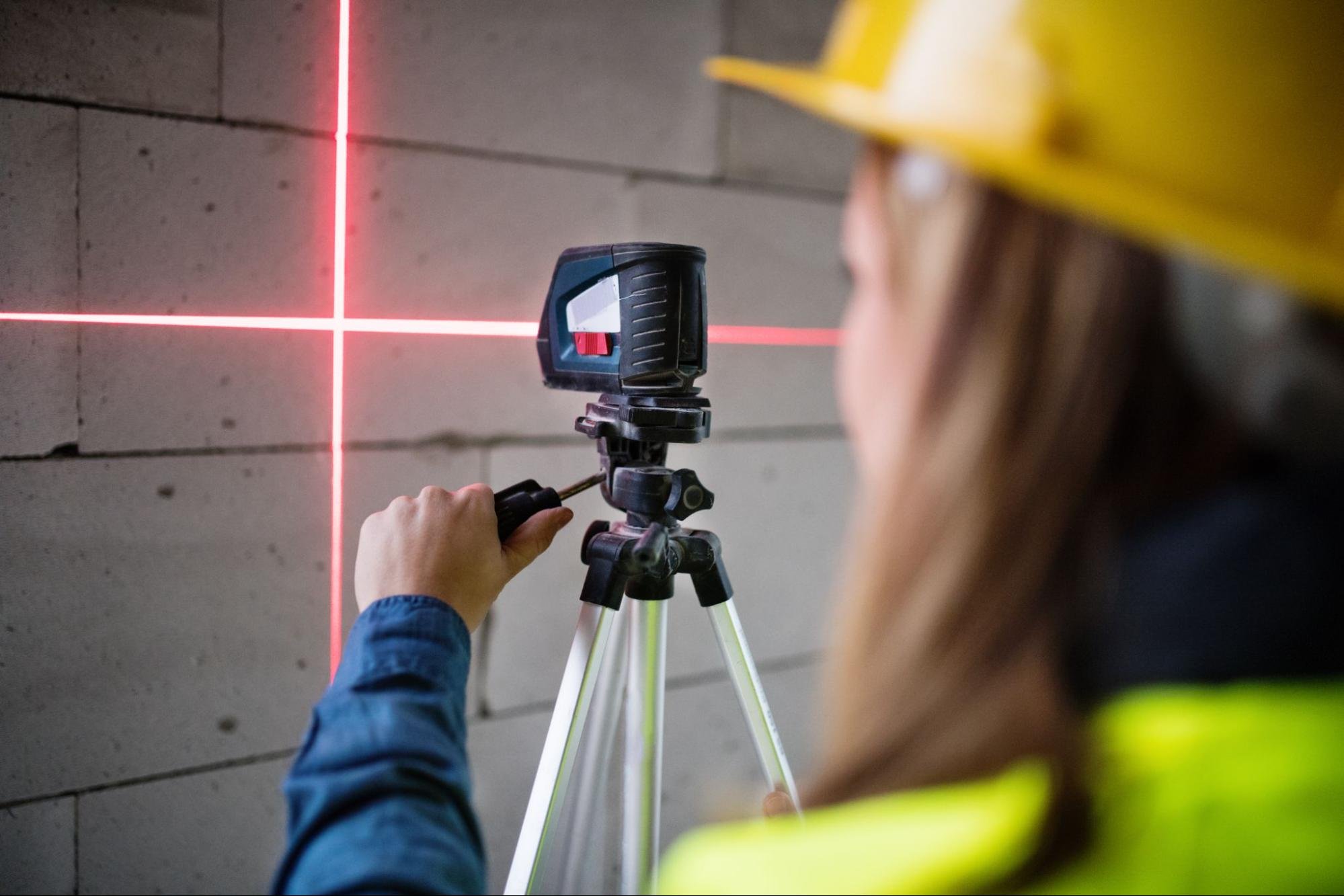
Survey professional using 3D scanning equipment to capture accurate building data on a commercial project site

Reducing Dependence on Key Personnel

Many facilities rely on employees who understand the property's history and unique conditions. They may know where hidden utilities run, which areas were modified, or how certain systems connect. This knowledge becomes difficult to replace when experienced staff retire or move on. Three-dimensional scan data creates a detailed record of the property that remains available regardless of personnel changes. Future teams can access accurate information without relying on memory or informal notes. This continuity helps reduce disruptions and supports more informed decision-making.

Supporting Ownership Transitions

Commercial properties frequently change ownership, management companies, or operational teams. During these transitions, documentation is often incomplete, outdated, or scattered across multiple sources. Accurate scan data provides a reliable snapshot of the property at a specific point in time. New owners and managers can quickly understand building layouts, existing conditions, and previous modifications. This visibility reduces the learning curve and improves planning for future projects. As a result, property transitions become more efficient and less dependent on historical knowledge.

Improving Long-Term Property Planning

Building information becomes more valuable when it remains available over time. Commercial properties often undergo multiple renovations, upgrades, and maintenance projects throughout their lifecycle. Accurate scan data creates a historical record that future teams can reference when planning new work. Instead of starting from scratch, stakeholders can review existing conditions and past modifications in one location. This visibility supports better capital planning and helps teams make more informed decisions. Property owners gain a stronger foundation for managing assets over the long term.

Using 3D Scanning for Renovations and Fit-Outs

Renovations require accurate information from the beginning. Small documentation errors can create larger construction problems. Tenant improvement projects often operate under strict deadlines. Digital building data helps teams work more efficiently.

Preventing Costly Surprises During Construction

Unexpected site conditions often increase project costs. Teams may discover conflicts after construction has started. These issues can affect schedules and create additional work. Scan data helps identify potential problems before construction begins. Designers and contractors can address concerns during planning. This approach helps reduce costly change orders.

Helping Design Teams Work Efficiently

Design teams need accurate measurements before creating plans. Traditional methods often require repeated site visits. Scan data provides access to information from one source. Teams can review conditions without returning to the property. This efficiency allows projects to move forward faster. Property owners benefit from a smoother design process.

Improving Facility Management With 3D Scanning

The value of scanning extends beyond construction projects. Commercial buildings require ongoing maintenance and planning. Accurate records support those responsibilities. Digital documentation helps teams work with greater confidence.

Creating Better Building Records

Building records often become fragmented over time. Information may exist across multiple files and departments. This situation makes data difficult to manage. Three-dimensional scanning creates a centralized record of existing conditions. Teams can access reliable information whenever needed. Property owners benefit from stronger documentation practices.

Supporting Long-Term Property Operations

Facility managers need access to accurate building information. They often review layouts, equipment locations, and available space. Digital records make that information easier to find. Scan data can also support facility management software. Maintenance planning becomes more organized and efficient. Property owners gain better visibility into their assets.

3D Scanning Software vs Traditional Surveys

Traditional surveys still serve many purposes. However, commercial projects often require more detailed information. Reality capture technology provides a broader view of conditions. This difference affects both planning and project execution.

Accuracy and Data Collection

Traditional surveys collect information for specific requirements. Three-dimensional scanning captures a much larger dataset. Teams can revisit the digital model whenever questions arise. Additional measurements often require no extra site visits. This flexibility supports both current and future projects. Property owners gain access to more comprehensive building information.

Efficiency and Accessibility

Project teams frequently need information after site visits end. Traditional methods may require additional fieldwork. Scan data remains available through the digital model. Architects, engineers, and contractors can review conditions remotely. This accessibility improves collaboration across project teams. Property owners benefit from faster decision-making.

Understanding 3D Scan Costs and Return on Investment

Cost matters when evaluating any new technology. Property owners want to understand potential business value. Scanning requires an upfront investment. The benefits often continue long after project completion.

What Influences Scanning Costs

Several factors affect project pricing. Building size and complexity play major roles. Accessibility can also influence project requirements. Additional deliverables may increase overall costs. BIM models and digital twins often require extra processing. Property owners should evaluate value alongside pricing.

Where Property Owners See Value

The value of scanning often appears across multiple projects. Accurate data helps reduce planning errors. Teams spend less time gathering measurements. Better information can reduce delays and rework. Facility operations may also become more efficient. These benefits can support long-term cost savings.

Common Questions About 3D Scanning Software

Many property owners ask similar questions before investing. Most concerns involve accuracy, maintenance, and long-term value. Understanding these topics supports informed decisions. The following answers address common questions.

Is it Accurate?

Modern scanning technology delivers highly accurate measurements. Results depend on equipment, workflows, and site conditions. Professional providers follow established quality standards. Many organizations use scan data for design projects. Others rely on it for facility management activities. Accurate records support more confident decision-making.

How Often Should a Building Be Scanned?

The answer depends on how often conditions change. Buildings with frequent renovations need more updates. Stable properties may require fewer scanning projects. Major improvements often justify new documentation. Updated records remain more useful than outdated drawings. Property owners should review needs after significant changes.

Can it Support Facility Management?

Facility teams use scan data in several ways. They can review layouts and locate building assets. Maintenance planning becomes easier with accurate records. Digital information supports faster access to critical details. Scan data can also be integrated with management platforms. Property owners gain a valuable operational resource.

Adopt 3D Scanning Software Before Records Fall Behind

Building records lose value when they no longer reflect reality. Every renovation, upgrade, and tenant change affects existing conditions. Accurate digital documentation helps property owners stay ahead of those changes. Investing in 3D scanning services today can support better planning, stronger operations, and more informed property decisions tomorrow.

Building data is only as valuable as the decisions it supports. Visit the LNE Surveys blog for practical insights on surveying, reality capture, and property documentation.