
When you’re documenting an existing building—whether for renovation design, BIM modeling, as-built survey plans, or construction verification—the quality of your measurements sets the ceiling for everything that follows. If the “as-is” data is incomplete or inconsistent, designers make assumptions, contractors hit surprises, and schedules get squeezed by rework. Traditionally, that documentation meant crews on site with tapes, lasers, total stations, and field notes, collecting targeted dimensions and sketches. Today, point cloud capture—most commonly via 3D laser scanning—has changed the workflow by recording millions (sometimes billions) of spatial data points that can be revisited later. But that doesn’t mean point cloud is always the right answer, or that traditional field measurements can’t be the smarter choice in the right scenario.
How Do Point Cloud and Traditional Field Measurements Work?
Point cloud methods can capture complex geometry quickly and preserve a detailed digital record, while traditional field measurements can be efficient and cost-effective for simpler spaces or limited scope.
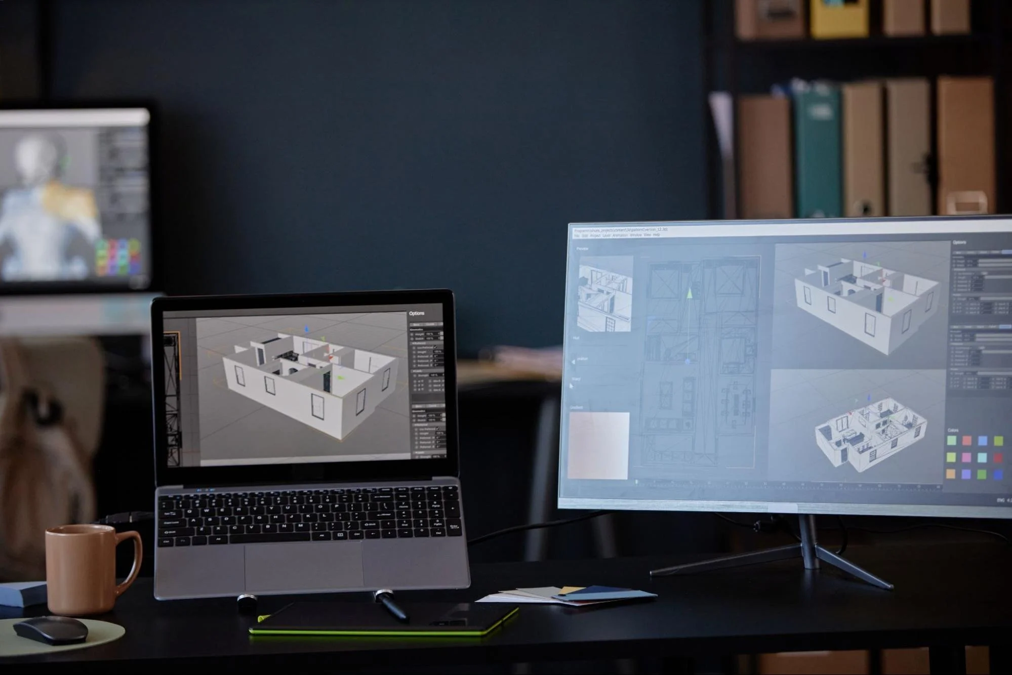
What a Point Cloud Is and Why It Matters
A point cloud is a dense collection of 3D points representing surfaces in a real space, created by laser scanning or photogrammetry. Each point has coordinates in a shared system, and together they form a digital “snapshot” of walls, floors, ceilings, beams, and visible MEP elements. Unlike a few spot dimensions on a sketch, a point cloud captures geometry broadly so teams can extract measurements later, create 2D drawings, or build a 3D model with far more context. The biggest advantage is that it preserves site conditions as they were on the day of capture, which can reduce return visits and disagreements about what exists.
The Process of Traditional Field Measurements
Traditional field measurements involve collecting the specific dimensions needed for a defined deliverable—room sizes, door and window locations, ceiling heights, key structural offsets, and notes about conditions that matter. The method is highly intentional: measure what you anticipate needing, document it carefully, and move on. Because it’s selective by nature, it can be very efficient on simple projects and smaller sites where complexity is low, and the scope is clear. The tradeoff is that the process depends on field judgment: if a critical offset or elevation isn’t captured, it may require another site visit or force design assumptions.
The Coverage of Point Cloud vs. Traditional Field Measurements
The simplest way to compare the two methods is coverage: point cloud capture collects broad geometry across everything visible, while traditional field measurements collect discrete dimensions chosen by the surveyor or technician. That difference matters most on existing structures where “unknowns” are common—out-of-plumb walls, sloped floors, undocumented soffits, or legacy MEP that doesn’t match drawings. With point cloud, you’re less reliant on predicting which dimensions will matter later because the dataset preserves a wide view of the space. With traditional measurements, you can still achieve a strong result, but it requires careful planning, thorough checklists, and experienced field judgment to avoid gaps.
Scanning Records More by Default
Broad capture reduces risk when a project has tight tolerances or lots of interfaces.
Manual Coverage Depends on Scope Clarity
The clearer the deliverables and constraints, the more efficient traditional measurement becomes.
Point Cloud Accuracy Depends on Workflow
Point cloud can be extremely accurate, but results depend on scan planning, site conditions, and how scans are registered together. Proper control, good target placement, and consistent registration steps help ensure the dataset aligns correctly and maintains accuracy across spaces. Point cloud accuracy can also vary based on distance, angles, and line-of-sight limitations, so experienced scanning teams design a capture plan that minimizes occlusions and keeps critical geometry well-defined. The payoff is broad accuracy across many surfaces, which is especially helpful when coordination or retrofit work requires confidence beyond a handful of spot dimensions.
Registration Quality Is Everything
If scans aren’t properly aligned, the dataset can drift and produce misleading geometry.
The Plan Should Prioritize Critical Zones
High-risk areas such as tight ceilings, shafts, and mechanical rooms require intentional capture positions.

The Accuracy of Traditional Field Measurements
Traditional field measurements can be highly accurate on the dimensions you capture, especially when skilled crews use calibrated tools and consistent methods. The challenge is that accuracy is typically focused on measured points, while unmeasured areas are treated as assumptions or estimates. In practice, this means traditional measurement can be excellent for simple floor plans and general layouts. Still, it becomes harder to maintain confidence when you need dense verification—like verifying beam pockets, checking slab edges, or confirming the exact route of existing utilities. Accuracy isn’t just about the tool; it’s about completeness, and traditional workflows must balance the need for detail with the time available on site.
Accuracy Is Dimension-By-Dimension
You can be extremely precise in your measurements, but you may have limited information elsewhere.
Checklists Protect Results
Strong field processes reduce missing data and help the final drawings remain reliable.
Point Cloud Workflow Speed on Complex Sites
On older commercial buildings, dense MEP areas, irregular structures, or active facilities, point cloud workflows can reduce the time spent chasing dimensions and revisiting the site. Instead of measuring every offset and elevation in the field, teams focus on capturing scans from positions that eliminate blind spots. Office staff can then extract what’s needed without disrupting operations again. Traditional field methods can still be fast in simple spaces, but complexity often increases time nonlinearly because every overlooked offset becomes a future delay.
Complexity Favors Scanning
The more interfaces and constraints, the more point cloud reduces missed measurements.
Field Time Shifts to Office Time
Scanning can shorten site visits but may add processing and modeling time after capture.
Traditional Field Measurements Win on a Small Scope
For small projects—like documenting a few rooms, verifying a simple addition, or confirming a limited set of dimensions—traditional field measurements can be the most efficient approach. If the deliverable is straightforward and the building is not geometrically complex, taking targeted measurements may produce everything needed without the overhead of scan registration, data management, and point cloud processing. Traditional methods also work well when access is limited and scanning positions are constrained, making it hard to capture a clean dataset. In these situations, the key is a clear scope definition so the field team measures the right items the first time.
Less Overhead Can Mean Faster Delivery
If you don’t need dense geometry, simple measurement can be the quickest path to usable results.
Tight Access Can Limit Scanning Value
When line of sight is limited, traditional tools may be more practical than a partial scan.
Using Point Cloud to Reduce Coordination Risk
Point cloud data can significantly reduce coordination risk by supporting design decisions with real geometry rather than assumptions. That’s especially valuable for renovations where ceiling space is tight, and rerouting systems requires confidence in clearances and existing conditions. With a solid scan, teams can validate soffits, verify beam depths, locate visible utilities, and coordinate MEP systems more effectively before construction begins. Traditional field measurements can support coordination as well, but scanning tends to perform better when multiple disciplines need to reference the same “truth” about existing conditions.
Better Existing Data Means Fewer Surprises
When teams model against reality, they’re less likely to discover conflicts after demolition.
It Improves Clash Detection Inputs
Coordination models are stronger when the existing structure is accurately and consistently captured.
Point Cloud Limitations You Should Plan For
Point cloud capture records what it can see, so anything concealed above ceilings, inside walls, or behind fixed objects may remain unknown without additional investigation. Reflective surfaces, glass, and active sites with movement can introduce noise or gaps, and large datasets require software, hardware, and workflow discipline to be useful. It’s also important to remember that scanning is only one part of the deliverable—someone still has to interpret the data, extract measurements, and produce drawings or models. The best outcomes come when scanning is paired with clear deliverable standards and field verification where needed.
Hidden Conditions Still Need a Strategy
Selective openings, as-builts review, and verification are still important when utilities are concealed.
Data Without Deliverables Doesn’t Help
A point cloud is valuable only when it’s translated into the drawings or BIM outputs your team needs.
Choosing Between Point Cloud and Traditional Field Measurements
The right choice depends on complexity, risk tolerance, schedule, and what you need the data to support. If you’re coordinating multiple trades, modeling tight MEP spaces, or documenting irregular existing structures, point cloud capture often provides the coverage and confidence needed to reduce rework. If your scope is limited, geometry is simple, and deliverables require only targeted dimensions, traditional field measurements may be more cost-effective and faster to turn around. Many successful projects use a hybrid approach—traditional measurements for quick checks and control, with point cloud capture reserved for complex zones where dense verification adds real value.
Explore our LNE Surveys blog for more practical guidance on point cloud capture, traditional field measurements, and choosing the right approach for existing-building documentation.